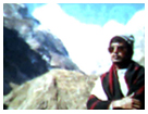
My Journey to HAR KI DUN ( Swargarohini Peak )
HAR KI DUN IS A VALLEY OF GOD. This place has a mythological importance, it is believed that PANDAV of Hindu epic Mahabharat went to Swarga (Heaven) through this Swargarohini mountain. This holly place is also heaven for trekkers.Trekking from Sankri through Govinda wildlife sanctuary via the picturesque village of Taluka & Osla or Seema to HAR - KI - DUN is really enjoyable. HAR-KI-DUN is located extreamely in the north - western side of Garhwal in Uttarkashi district at an altitude of 3566n metres and Yamuna & Sutlag basin are scattered along both side. It is also the base of Fateh mountain.
HAR KI DUN
Posted by Swapan Kumar Chowdhury 0 comments
Labels: HAR-KI-DUN is valley of God
Valley of Flowers and Hemkund Sahib.
This time, I started my journey for Hemkund and Valley of Flowers. Both the Himalayan picturesque spots lies amidst scenic surrounding in Uttranchal. Travellers may travel both the spots altogether as the route is same except last 5 or 3 kms trekking bifurcated in two direction from GHANGARIA. If anyone is more enthusiastic, may also include with this trip the holy Hindu mythological place BADRINATH which is only 20 kms from Govinghat or 48 kms from Joshimath.
Before starting for Valley of flowers and Hemkund Sahib , let me tell how easily and economically one can access the spots from different part of the globe.
The capital of India, DELHI is well connected with main cities of the world by air and also rests of country. The nearest airport is Jolly Grant in Dehradun and it is well connected by road with small town Joshimath or Govindghat via rishikesh.
Delhi is connected to Haridwar, Rishikesh and Dehradun by train. Last railway station in this route is Dehradun. But it is always better to break at HARIDWAR as the city is the center or also starting point via Rishikesh towards Valley of flowers and Hemkund Sahib.
Travelers from Delhi may also start journey by bus from ISBT, Kashmire Gate for Haridwar or Rishikesh.
Direct bus service for BADRINATH is available from Haridwar, travelers may avail this bus service and break his journey at Govindghat which is located 28 km before Badrinath. , but it is better to start journey from Rishikesh. In Rishikesh local private bus or Garwal Nigam bus are available. All bus plying are start before 9 am in morning because no bus is allowed to run in night in this hilly reagion, approx time to reach Joshimath or Govindghat is 10 to 11 hrs. One may also takes Jeep or Sumo hiring personally. One thing one must consider before starting journey is where he should break his journey for night staying. Two alternative are available, one is to halt for night staying at JOSHIMATH and be prepared for next morning– drive 20km more to reach GOVINDGHAT, from where actual trekking for HEMKUND and VALLEY OF FLOWERS starts. The other alternative is to travel by bus or Jeep up to Govinghat in the same day and halt for night staying in Gurudwara where free accommodation and meal is available, then starts trekking early in the next morning .
First Day
I started my journey by Garhwal Nigam bus for Govindghat, actually the bus was
going to BADARINATH. Being a local bus it was stopped now and then in every stoppage for the local people. No doubt it was taking more time, but it was better to know more about the local people and their custom and also to visit closely small town and holy confluences of rivers. Gradually we were climbing higher and higher along with the river ALAKANANDA. Road ahead is winding in zigzag way and below the deep slope river Alakananda is flowing with gurgling voice. We we were passing one by one small town Devprayag, Srinagar, Rudraprayag, Karnaprayag , Nandaprayag etc. The panoramic view of prayags from road is really enchanting. Prayag is the meeting place of two or more rivers, these prayags also bear the mythological importance. One can view these enchanting picturesque sceneries, specially the confluences (Prayag) of rivers along the deep end of the slopes - somewhere a temple stands by the side of prayag , is worthy to glimpse from the high slope of road.
Devprayag is the meeting place of two holy river Alakananda and Bhagirathi , from here onwards the river is known as Ganga.
Another prayag out of “Panch Prayag” is Rudraprayag the confluence of holy river Alakananda and Madakini. Our bus was crossing one after another holy confluences.
Then came to Karnprayag where river Pindari embraces Alakananda, it is the third confluence on river Alakananda.
The forth prayag on Alakananda is Nandprayag another sister river name Nandakini meets here.
After Climbing more and more , passing Chamoli I reached to Joshimath – the small important town nearest to Baradinath, Hemkund and Valley of Flowers.
The height of Joshimath is 2100m above sea level whereas the height of Rishikesh , from where journey started is 370m , so one can easily guess how much we climbed in 255 km distance. Travelers have to trek at altitude of 3000m (Govinddham or Ghangaria), 3300m(Valley of Flowers) and 4329m (Hemkund) from 2000m(Govinghat) i.e. have to hike approx 2329m by trekking 20km . Therefore, some tourists break their journey at Joshimath as preparation for tough trekking to Hemkund. In this small town you can find everything you need for trekking. Travelers may stay in Forest bungalow, hotels and Dharamshalas. One of the main Sankaracharya maths are situated here. Badrinath ji is worships at Narasimha Temple in Joshimath , when Badarinath temple closes in winter. Travelers may also stay at Auli a famous ski resort situated at altitude of 3048 m is only 20 minutes distance by ropeway.
After Joshimath bus reached Govindghat in the evening. I got down from bus for here which was going to Baradinath. Gobindghat is the take off point for Valley of Flowers and Hemkund. Gurudwara and forest rest house are only lodging available in Govinghat. I spent the night in Gurudwara. Among the tourists 99 percent were found Sikh pilgrims who came to visit Hemkund Sahib. Free accommodation and meal are provided in the Gurudwara. Pilgrims starts their yatra(Trekking) in the morning after prayer and having halva prashad from Gurudwara.
In the morning it was felt that Govindghat is like very small town , some Dhabas were located at the point from where actual trekking starts. Some porters and horses for hire were waiting to offer their service. I began to hiking for 14 km up to Ghangaria, which is also known as Gobinddham. Trekking started crossing a small bridge over a river, flowing along in the valley from Ghangaria to Gobindghat is known as Lakshman ganga. Trekking route to Ghangaria is almost well maintained track. The path was seems almost crowed by the Sikhs pilgrims. Some pilgrims were climbing riding on horseback and some by pitthu (porter). Pilgrims on horseback were ascending a little faster then pedestrian pilgrims. Price of goods in road side Dhabas were more, informed that price would be more and more as we hiked more. Trekking in some narrow passage becomes risky when horse hurriedly passed by carrying goods to Govindham. Pedestrians should always be careful, even to enjoy the picturesque beauty of valley while trekking may sometimes tumbled – always should stop in safe place not in motion to view the enchanting landscapes. On the way found a very small village comprises three or four houses. I took a little rest front of a shop and began trekking again. Some pilgrims to Hemkund shahib were trekking in religious mode by chanting continuously “Sat Nam Wahe Guru” I
It was then afternoon when I reached Ghangaria. This village is actually uses as base camp for Hemkund Sahib and Valley of Flowers. Generally all Sikhs pilgrims stay at Gurudwara but anyone can also get free accommodation here. Besides, some hotels, restaurants and GMVN guesthouse or rest house are main buildings in this village. All buildings are erected affix to main path, which seems a bye lane of a small market. It was then begun raining, I hurriedly entered in the forest rest house where I somehow managed a place for spending the night by requesting caretaker Premprakash. I met here with another tourist who came from France and chatted with him sitting under umbrella in rain. It was gradually covering darkness everywhere in the evening, I came to my room and noticed through window that pilgrims were still coming and busy to finding a suitable lodging by soaking in rain.
Third Day
Early in the next morning , I went out for my n ext trekking. Trekking a bit found the valley is the meeting place of river Pushpabwati is flowing from Valley of flowers and Laksma nganga coming from Hemkund. A little ahead path is bifurcated in two direction one path in the right to Hemkund and in left direction to the Valley of Flowers. The steep 5 km long path reaches to the sacred “Lake of ice” at altitude of 4329 metres, which is popularly known as Hemku nd or Lokpal lake. Seven peaks surround the lake or Kund is one of the popular pilgrimages for Sikhs. The water of the lake is feed by the glacier fromthe Hathi
It took 4 hrs to trek this steep tough 5 km route to Hemkund. This last part of trekking out of 20 km from Gobindghat is the most difficult trekking. Generally trekking from Ghangaria to Hemkund takes 4 to 6 hours but actual time varies upon the physical ability of a tourist. I began resting frequently, and thought to rest for long time but after a little rest amidst nature’s picturesque surroundings rejuvenated quickly. Finally reaching the holy place found, a Gurudwara is erected on the bank of Hemkund (Lake of ice). It is truly called Hemkund because water of this Lake remain frozen almost seven months in year and it is not accessible during this time. When nature becomes favorable in the month from May to September, snow and ice of the lake began melting and Sikh
The Valley Of flowers was discovered by FRANK S SMYTHE in the year 1937 , who was a mountaineer and botanist. He also written a book called "The Valley of Flowers" which unveiled the beauty and floral grandeurs of the valley and open the door to the flower lovers. Again , in the year 1939 a botanist name Miss Margarate Legge was deputed by the botanical gardens of Edinburgh for study the valley but unfortunately she was lost her life while collecting some flowers on the rocky slope. One can see a erected memorial which was built by the sister of Margarate Lagge on the spot where local people buried her. The valley is still link with the thoughtful memory of the flower lover Lagge. The following words are inscribed on the stone of the grave :-
"I will lift mine eyes unto the Hills from whence cometh my help."
This place where no big plant is seen, despite of that the valley was covered with grass and some rock with vast expanse of different colour flowers. Some are white, some red and some heavenly blue colour flowers make the place a dazzling land. If anyone is really love flowers one day is not sufficient here, he must stay for more days for detail studies.
Posted by Swapan Kumar Chowdhury 1 comments
Table of Distance - Hindu mythological places in Utranchal.
One can reach Haridwar or Rishikesh or Dehradun from Delhi or rest of India by train And also by air to Dehradun, there after only by road.
Bus services are available from Haridwar for
- Badarinath 334 kms. by bus.
- Kedarnath - 235 kms upto Gaurikund by bus, then 14 kms. on foot
- Yamunotri - 233 kms uoto Hanuman Chatti by bus, then 13 kms on foot.
- Gongotri - 272 kms by bus.
- Gaumukh - 272 kms upto Gongotri by bus, then 18 kms on foot.
- Hemkund - 294 kms upto Govind Ghat by bus, then 20 kms on foot.
- Valley of Flowers - 294 kms upto Govind Ghat by bus, then 19 kms on foot.
Posted by Swapan Kumar Chowdhury 0 comments
Labels: 5. Road distance from Haidwar to some religious places.
TUNGNATH TO BADRINATH and back to RISHIKESH
L A N D O F G O D S
Traveled through the Central Himalayas in Uttar Pradesh (now, Uttaranchal) across the districts of Dehradun, Uttarkashi, Tehre-Garwal, Chamoli and Pauri.
The Routes I reavelled during this journey are
- GANGOTRI-GAUMUKH
- KEDARNATH – GANGHI SAROWAR
- DOGAL BHITA-CHOPTA-TUNGNATH
- BADRINATH – MANA – VYASA GUMPA – BHIMPOOL
- RISHIKESH
After TUNGNATH our next main spot was BADRINATH. So, taking breakfast in Mangal Sing’s Hotel , we started bus journey for GOPESWAR . On the way, we found the Entrance to SATI PIT ANNUSWAH’s Temple. When our bus reached GOPESWAR, we were surprised by seeing this small beautiful district Head Quarter of Chamoli – though we had a mind to stay in this beautiful place, but to reach our destination BADRINATH before closing of the Temple (Generally Temple closes in the last week of October), changed a bus here for CHAMOLI. This route to Chamoli is connected to main route from Rishikesh to Badrinath. We again changed here at Chamoli for 134 kms long journey to our destination BADRINATH. This was excellent bus journey along the river “ALKNANDA’ flowing sometime in the right and sometime in the left side. By reaching BADRINATH at 17 hrs., found the holy town as a town of fantasy, a huge number of hotels and dharmasalas were scattering here and there but most were under lock and key. The strong cool wind made us more discomfort in finding a logging. After a while we somehow managed Bhagirathi Lodge and spent the night there.
BADRINATH Temple is situated at the confluence of RISHI GANGA and ALAKNANDA at a height of 3110m above sea level. Once BADRINATH PURI was surrounded by wild BADRI or BERRIES and so it was named “BADRIVAN’ and thus now modified the name as Badrinath. Badrinath is between the valleys of NARA and NARAIN range near the towering NEELKANTH peak. It is better to say, situated on the lap of Narain Parvat near TAPTA KUND. The idol of Lord Bishnu (Badrinath) is made of black stone (Shaligram) and seated in a PADMASAN POSTURE. Devotees can see the idol of Lord as BRAHMA, VISHNU, MAHESH, HANUMAN and KALI, what so ever form they think almighty - all pervading in one. There is no historical record available as its origin or to the age of the holy Temple. But one can find reference of Lord BADRINATH in Hindu’s mythological books VEDs. During the regime of ASHOKA the temple was worshiped as Budhist Temple, mythological SKAND PURAN, say that the idol of Lord BADRINATH was recovered by SHANKARACHARYA from WARD KUND and re-shrined in this Temple in 8th century A.D.
On 27th October , we got up early in the morning and lucky enough to had a beautiful clear day. Our first duty was Darshan of BADRI BISHAL, so I bought a bucket of warm water from TAPTA KUND by paying Rs. 4/- to a local man. Being refreshed with this warm water went out to the Temple. Just in front of the Temple there are hot water springs comes out from GARUR SHILA and fall into the tanks. A dip in NARAD KUND and TAPTA KUND considered very holy and everybody dips in the both Kunds before going to Darshan Bdrinath Bishal . Badrinath is a place of Dharas. The PANCH DHARA, PRAHLAD DHARA, KURMA DHARA, URVASI DHARA, BHRIGU DHARA and INDRA DHARA are most famous Dhara in Badrinath. We also had a darshan BADRI BISHAL NARAYAN and there after began trekking along the bank of ALAKNANDA – morning view of towering NEELKANTH peak along with NARAIN PARVAT was worthy bearing in mind. Here one could find a valley at the back side of the Temple - a gap open towards NEELKANTH peak which symbolizes all spirituality of the holy land of BADRINATH. Then after taking light food and tea we again began trekking on the opposite side of ALAKNANDA. On the lap of NARAPARVAT, there are two small lakes in which a large stone known as SESHA-NAG was formed naturally, is also thing to memorize. CHARANPADUKA is 2 km from here.
Our next spot was to the last far-off village of the North-India, MANA 3 kms from BADRINATH. We began to trek – motor road is available up to MANA from Badrinath for military camp. Foreigners are restricted to trespass the area. In MANA, Temple of MATA MURTI is situated in the opposite side of the village. In the village tea-stall we took a little rest, - talked to the local peoples, one local man named Manshing Molpha who was retired from Indian army talked very frankly with us. Most surprisingly found him speaking Bengali, which he learned in service life at TRIPURA. He offered us MANA MADE WINE but hesitated to take, lastly on his pushy request took a little for his honour. In the mean time, many local people gathered there, wanted to know about us. We all were pleased with their sacred mind and faithful attitudes. Simple mind and faith on hill is precious capital of the people - worthy remembering. This village is full of caves, so it may be called CAVE VILLAGE. VYAS GUPHA, GANESH GUPHA, BHIM GUPHA are visible here.
We again started trekking in a complete rocky mountain, which was surrounded by various form of large stones. No one was there in VYAS GUPHA, but opening the door we found VYAS DEVA i.e. a small statue. This is the place where He wrote our (Hindu) mythological four VEDS. Then we climbed up the roof of the GUPHA, from where partly snow-clad majestic view of NARA PARVAT is visible.
Then we came down to the route between two range of hills where SARASWATI and ALAKNANDA are met together, called KESAVAPRAYAG. VASUDHARA fall is 3 kms from here. One can see ALAKPURI GLACIER from VASUDHARA. The mountain of NARA and NARAIN meets at CHAKRATIRTH, which is 21 kms from BDRINATH. SAPTOPANTH Lake is 25 kms from BDRINATH situated at a height of 4402m above sea level. Trekking to SATOPANTH is dangerous because weather is generally unsettled and unexpected here. We saw many waterfalls in KEDARNATH route, so did not trek more. Moreover some local peoples advised us not to proceed further as we were late and might be in strong snowdrift wind in the evening. Seeing BHIMPOOL Bridge on the river SARASWATI , we returned from MANA. In the evening we took a little rest after whole day trekking. Then after a while, I went to the Temple with Madan, had a last Darshan of BADRI BISHAL NARAYAN. These new partners from Nabadwip were always very energetic, prepared ‘KHICHURI’ as dinner by their own stove and pressure cooker, truly a homely food on this extreme North-India on 3163m above sea level.
28th October was the day of returning down to Rishikesh, The chanting of Vedic hymns and chiming of bells awoke us early in the morning. Though I had a mind to visit KALPESWAR via HELENG , but changed my mind and accompanied with them in the Rishikesh bus at 6 o’clock in the morning. This was long 298 kms long bus journey in a zig zug up and down course in Himalayas varying altitudes 3110m to 472m. There is gate system from Badrinath to Joshimath route. The first gate is at 6-30 hrs. and last at 16-30 hrs in the evening. The system is to avoid accidents and safely reaching destination before darkness, maintaining timing is very important here.
Our bus stopped at PIPALKOTI, where we took breakfast. We passed through many mythological places –
DEVDARSHNI,
HANUMAN CHATTI,
PANDUKESWAR it said that king Pandu lived here during the last few days of his life.,
GOVIND GHAT ( this is the place from where I trekked alone to HEMKUND and VALLEY OF FLOWERS., detail is available in my other post),
VISHNUPRAYAG a meeting place of ALAKNANDA and DHAULI GANGA,
JOSHIMATH the seat of Adiguru SHANKARACHARYA this is most town on Badrinath route,
KALPA BRIKSHA is 2400years old is visible here,
HELANG –Kalpeswar Mahadev, which is one of the Panch Kedar, is 9 km from here,
GARUR GANGA,
PIPAL KOTI,
CHAMOLI,
NAND PRAYAG- here Nandakini coming from glacier located near Nanda Devi meets with ALAKNANDA,
KARNAPRAYAG the name is associates with KARNA, a popular hero of Mahabharata. Pindar flowing from the glacier PINDARI. ALAKNANDA and PINDAR formed here a PRAYAG. Roads coming from RANI KHET and KAUSANI meet here,
RUDRAPRAYAG – This is the junction of roads to the shrine of Sri BADRINATH and SRI KEDARNASTH situated at the confluence of MANDAKINI flowing from Kedarnath (84 kms) and ALAKNANDA coming from Badrinath (159 kms). The ancient Temple of RUDRANATH JI and JAGDAMBA DEVI are visible,
SRINAGAR – In this ancient capital of Tehri-Garwa. We took our lunch hurriedly in this place,
DEOPRAYAG – This is the first important town on this Badrinath route from Rishikesh. This is the confluence of ALAKNANDA and BHAGIRATHI . Bhagirathi coming from GAUMUKH becomes HOLY GANGA at DEOPRAYAG. The crystal clear holy flows together in green-white color at this confluence, and then only HOLY GANGA is worthy seeing even from the bus running on the high hill. Moving in zig zug way at last we reached Rishikesh at about 19 hrs in the evening. We spent that night at KALI KAMLI WALI dharmasala (NEW Building) at Goal Market.
On 29th October, we got up lately, as we had no program that day. I bide goodbye to my four travel companions Rabi, Madan, Balai and Ram, they went to Haridwar by train and I stayed Rishikesh to experience loneliness in the ancient spiritual town for the whole day and night.
Awaking early in the morning on 30th October, boarded bus for Delhi, and reaching Delhi, spent the night in Old Delhi Rly. Station’s deluxe dormitory with one ‘my dear Gujrathi gentleman’.
This day of 31st October, was to returned home by Brahmaputra Mail. Whole the day I passed by roaming in New Delhi with the Gujrathi gentleman who had a work in Russian Embassy.
In the evening I suddenly found Mr. Madan Mohan Chakraborty (office colleague) with his family in the waiting room. He had confirmed his reservation earlier, so I traveled with them without facing any troubles and finally reached KAMAKHYA (GUWAHATI) in schedule time.
“OM NAMO NARAYANAYA”
“ OM NAMASSIVAYA “
Posted by Swapan Kumar Chowdhury 0 comments
GAURIKUND TO TUNGNATH
Traveled through the Central Himalayas in Uttar Pradesh (now, Uttaranchal) across the districts of Dehradun, Uttarkashi, Tehre-Garwal, Chamoli and Pauri.
The Routes I reavelled during this journey are
- GANGOTRI-GAUMUKH
- KEDARNATH – GANGHI SAROWAR
- DOGAL BHITA-CHOPTA-TUNGNATH
- BADRINATH – MANA – VYASA GUMPA – BHIMPOOL
- RISHIKESH
It was then 10-35 hrs. When we reached CHOPTA. We kept our luggage in the custody of Mangal Sing , a hotel owner - then started trekking 3.4 km ascending high route to visit TUNGNATH Temple.
Mangal Sing is owner of a small hotel, which is situated just at the bottom of TUNGNATH hill. At first appearance, it would look as a small shop, but fresh footings and lodging also available in this small hut of Mangal Sing.
The weather was turning awful, everything was gradually going under the cloud – even the gigantic mountains were vanishing one after another. We were then just trekked only for 2 km, and came to a place to take a little rest, but cool windy weather made us more restless – clouds were floating even in our height that we could not see the route we crossed and the route ahead – the entire route was missing and felt that world had finished just near the slope, only a infinite sky existed – we were in confusion whether it was a dawn or evening in the mid 12.50 hrs of noon. We began to trek hard and faster to get rid of cold.
On reaching TUNGNATH at 14-15 hrs., we found that temple priest was ready to come down to CHOPTA with some pilgrims. On seeing us the priest took us to the TUNGNATH Temple for darshan and puja, then advised us to return to CHOPTA with him because the weather would be very bad at night here. But we only five boys on the day of Dewali wished to spend the night here with an expectation of having a clear sky morning. It was then only 16-00 hrs in the evening but we were feeling very cool and it was became impossible to stay outside in the strong cold wind. The young Dilbug Sing was very helpful, he arranged fire in his small hut collecting woods from the hills. All Rabi, Madan, Balai and Ramlal were very pleased by sitting around the fire, wearing shawl on their bodies. They were in so comport that even refused to response the call of nature. I went out to witness sunset in this cloudy weather, saw excellent scenery in west. The reflected ray scattered over the thousand of hills with radish layers of clouds, seems as an ocean of flame with thousands of calm waves. Only I was there alone to witness the marvelous scenery on TUNGNATH, I felt myself very lucky - thank GOD.
The famous Temple is situated at a height of 3680 m above sea-level and from here one can view the peaks of PANCH CHULI, DUNAGIRI, NILKANTH, KEDARNATH, YAMUNTRI, GONGOTRI, BANDAR PUNCH AND NANDADEVI. This place is 3.4 km from CHOPTA
It was 19-30 hrs. Dilbar Sing brought our dinner to the fireplace, where we were sitting around in the comfort of fire. Soon after taking meals everybody fell asleep, But Rabi and myself gossiped long time with the Dilbar Sing. He was a good speaker, told us many stores - about Garwal and Nepali girls, a love story with girl and how he had to faces difficulties in different places when he flew away with this girl. Now he is in home after a bitter experience. He described the story so lovely that we forgot to sleep, and concluded the story with the saying - he would marry a Rajput girl soon as being Rajput himself.
On 26Th October, we got up early at 5 O’clock in the morning but nobody wanted to come out from the comfort of the bed. At was then 6 o’clock in the morning a very clear sky day, everything were clearly visible. The long snow-clad range of Himalayas were viewing clearly, looking marvelous white peaks under the blue sky were really enjoyable. Taking tea, we started downward trekking from TUNGNATH Temple to CHOPTA.
We reached at the bottom of TUNGNATH hill and started to get ready for our next journey to GOPESWAR by Vuk-hartal bus at 9 hrs.
Posted by Swapan Kumar Chowdhury 0 comments
GONGOTRI TO KEDARNATH
Traveled through the Central Himalayas in Uttar Pradesh (now, Uttaranchal) across the districts of Dehradun, Uttarkashi, Tehre-Garwal, Chamoli and Pauri.
The Routes I traveled during this journey are
- GANGOTRI-GAUMUKH
- KEDARNATH – GANDHI SAROWAR
- DOGAL BHITA-CHOPTA-TUNGNATH
- BADRINATH – MANA – VYASA GUMPA – BHIMPOOL
- RISHIKESH
In the morning on 22nd October, left UTTARKASHI and got on the bus for TEHRI. Again at TEHRI changed the bus for TILWARA via GHANSALI and CHIRBATRI. This bus was passing through a fertile valley, many small villages were looking very marvelous on the slope of the hills. At GHANSALI bus stopped for half an hour, within the time I was able to exchanged my traveler cheque from the GHANSALI State Bank. The branch manager was so co-operative that within 10 minutes he handover cash. The bus started in zigzag hilly course, sometime upwards and sometime downwards through the valley , where Garwal girls and women with big baskets on their back were found working or going to their woks. In true speaking girls found by the road and working along side were very good looking, they were tall, slim, having sharpen nose and fair complexion. The added beauty was their shyness, they glimpses very shyly to the strangers. It is noteworthy that local people renders various services to tourists. When I changed bus at TILWARA, one local person helped me to get into the bus with my luggage.
Road coming from TEHRI meets the main road going to KEDARNATH from RISHIKESK. The road going along the bank of MANDAKINI and passes through a small town AGASTMUNI – a little town full of green forest. Then I reached GUPTAKASHI - where pujari of KEDARNATH live in this village. It is a important junction place to KALIMUTH, MADMAHESWAR and KEDARNATH. The view of snow-clad mountain peaks and CHAUKHAMBA are marvelous from here. The small villages NALA, PHATA, RAMPUR, and SONEPRAYAG are situated on the bank of MANDAKINI and SONGANGA. All of a sudden our bus became out of order when we were 4 km beyond to our destination GAURIKUND. The pact up bus mostly with local peoples became suddenly empty within a few seconds leaving me and four other tourists from west Bengal. Mysteriously all people were vanished in the surrounded darkness in the hills. So, I along with the other four young tourists were waiting on the side of road in a complete darkness , if any vehicle would be available and finally able to hired a taxi to reached GAURIKUND. . Since then I was included in the tourists group after a few days of my alone traveling. At 19-30 hrs. in the evening we reached GAURIKUND and spent the night with new company. These young boys were RABI DEBNATH, MADAN SAHA, BALAI HAZRA and RAMLAL PODDAR from Deara Para Ghat Road, Nabadwip, Nadia, West Bengal.
2 km more to KEDARNATH Temple
Children were carried by KANDI
In this entire route one can find green forest, lush valley, waterfalls and alpine flowers of various shade. At 13-45 hrs. we reached KEDARNATH , but the temple was closed at 13 hrs. The climate was very cold and windy , everybody were returning to GAURIKUND fearing heavy snowfall. Being Being last of October all hotels and Dharmashalas were closed, only one hotel KALIPRASAD was found shutting its door, but on our request the owner arranged KHEECHURI as lunch.
Background view of KEDARNATH Temple
The temple KEDARNATH set in an area of brown grassy land with towering crown of white snow at the top of the mountain in the background of the temple is looking worthy .
Gradually the afternnon became very cloudy and everything were under the cloud. It was felt too cold to stay outside. Many local people and saints advised us to go back to GAURIKUND, but we spent the night at BOMBAY LODGE with an expectation of next clear sky morning to experience the surrounded splendor of nature.
View of KEDARNATH Temple
We were very lucky on the 24th October – a clear sky morning for screening snow-clad beauty of peaks was gifted in front of our eyes. We could not stay more in the room, hurriedly came out by the attraction of beautiful background scenery of KEDARNATH temple. I felt a heavenly strange peace seeing KEDARNATH temple on the lap of dazzling beauty of nature. First of all, we entered the temple for darshan of KEDARNATHJI .
The famous temple is situated at a height of 3583 m above sea-level, on the slope of Himalayas, where LORD SHIVA’s LINGAM has been installed, and where perpetual snow-clad exits in its background towering peak. A story run that KEDARNATH temple was constructed by the PADAVAS to atone the commitment of sins after the great war of MAHABHARAT.
The temple is magnificent architecture but no historical records found relating its origin or construction. It has a MANDAP and GARBH GRIHA. In the center of the GARBH BRIHA there is a rock, which is worshiped as LORD SHIVA. In the temple morning puja is known as NIRWAN and evening puja as SHINGAR DARSHAN. Generally the temple opens during the last month of April and closes after the day of DEWALI FESTIVAL.
At Gandhi Sarowar
After DARSHAN at 8-25 hrs. we began trekking 4 kms upwards for BASUKI and GANGHI SAROWAR. Here three stream form a big glacier and DUDHA GANGA are all united to form MANDAKINI.
In the evening at 16-20 hrs. We returned to GAURIKUND, spent the night here.
Posted by Swapan Kumar Chowdhury 0 comments
GONGOTRI TO GAUMUKH
Traveled through the Central Himalayas in Uttar Pradesh (now, Uttaranchal) across the districts of Dehradun, Uttarkashi, Tehre-Garwal, Chamoli and Pauri.
The Routes I travelled during this journey are
- GANGOTRI-GAUMUKH
- KEDARNATH – GANGHI SAROWAR
- DOGAL BHITA-CHOPTA-TUNGNATH
- BADRINATH – MANA – VYASA GUMPA – BHIMPOOL
- RISHIKESH

THE TEMPLE OF GONGOTRI
A DIFFERENT VIEW OF BHAGIRATHI
I took a rest on the way to Gaumukh

With a German Tourist

RECOGNISED SOURCE OF GANGA

VERY ADJACENT TO GAUMUKH (CAVE)
STANDING NEAR GAUMUKH (CAVE)
Posted by Swapan Kumar Chowdhury 0 comments


